|
The Kennebunkport Conservation Trust now owns most of the islands in Cape Porpoise Harbor. According to Executive Director, Tom Bradbury, in a Dec 2008 interview with Down East magazine, “All the islands through here were used by Native Americans as summer camp sites. In fact, we’re forming an alliance with the Maine State Museum to do archeology work on several of the islands.”
The trust is also searching for the 17th century fort that was reportedly located on Little Stage Island, aka Fort Island.
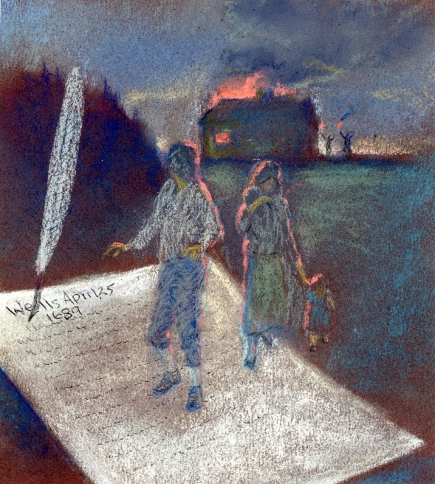
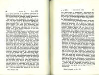
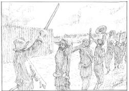
Kennebunkport history lovers have read the story of Nicholas Morey's heroic row, with a broken leg, from Cape Porpus to Portsmouth, to save his neighbors from a savage attack during King William's War. Charles Bradbury wrote that the inhabitants were cornered behind the fort on Stage Island, out of food and on their last round of ammunition. The Indians had stationed themselves at the narrow strip of land that, at low water, connects Stage Island to what we now call Fort Island and the inhabitants were facing certain capture or death. Nicholas Morey's reported success, in light of the perils of rowing alone, in a broken boat, in the dead of night, from Cape Porpoise to Portsmouth, NH, using oars made with 17th century technology, made this skeptical history lover want to see a little more historical proof.
Bradbury appears to have been the first to claim the fateful attack took place in 1690. The date has been repeated since by other historians. Bradbury also wrote that Edmund Andros returned to Boston in 1690. According to the Hutchinson Papers in Vol 242 of the Massachusetts Archives, and many other sources, Gov. Andros was deposed and imprisoned, April 18, 1689, during an uprising in Boston.
With all due respect to Charles Bradbury, without whose research we would not even know that an attack occurred and who did not enjoy the benefits of global keyword search, Google Books, Internet Archive, microfilm at the Massachusetts Archives or a library card at the Boston Public Library, I believe the attack took place in April 1689 and the rescue took place a day or two later.
Bradbury also refers to Lieutenant John Puddington who commanded the fort at Stage Island and mentions that soldiers deserted upon Andros' return to Boston. The timing and the details of the "desertion" are interesting. In a rough draft of a letter in his own hand, dated April 12, 1689, just 6 days before the end of his administration, Gov Edmund Andros wrote to Puddington ordering him to come to Boston immediately to answer charges that he had released the soldiers under his command against orders. (#368 at The Massachusetts Archives) Soldiers from Saco had deserted against the orders of their commander Capt. John Floyd. Andros also wrote to Captain Floyd ordering him to go after his soldiers and bring them back to Saco and then to relieve Lieutenant Puddington of his post in Kennebunk. (also Mass Archives)
The town of Kennebunk did not yet exist but the name Kennebunk was used in government documents to refer to the land on both sides of the Kennebunk River, including the fort at Stage Island. Puddington's soldiers and Floyd's soldiers were marching without a commander to Boston to participate in the overthrow of Andros' administration when Cape Porpoise was attacked. The original letters are on page 368-370 of Vol 242 Massachusetts Archives. (I have copies of the 2 handwritten letters) You can also read about them in a memoir of Edward Randolf Edward Randolph: Including His Letters and Official Papers for the New England, Pg 88. Edward Randolph was one of Andros' henchmen and was also deposed and imprisoned in April of 1689.
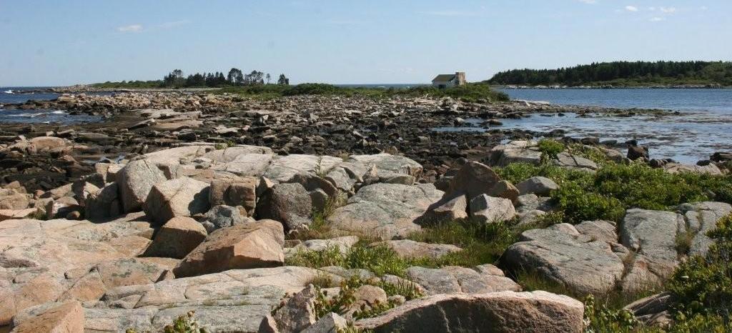
K Cmaylo Indian's Stage Island vantage point during the attack
 |
Desperate Letter from Wells
A letter, first discussed in 1903 and first published by the Colonial Society of Massachusetts in 1904 by Mr. Edmund M. Wheelwright, was sent from Wells to "ye superior power now being at Boston" and was dated April 25, 1689. Gov. Andros had been imprisoned and the inhabitants of Wells did not know who to address the letter to as the new King of England, William of Orange, had not yet appointed a new Governor. This letter seems to describe an incident at Cape Porpus almost exactly as Bradbury described the attack at Stage Island. Read A Desparate Letter from Wells at www.someoldnews.com Originally published in the York County Coast Star Dec 20, 2007
|
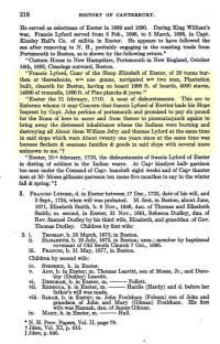 |
Francis Lyford sailed from Portsmouth to rescue inhabitants
New Hampshire Provincial Papers Volume XI pg 645 indicate that Francis Lyford of Exeter, NH requested reimbursement on February 21, 1710 for, at the request of Capt. John Perkins of Portsmouth, sailing his sloop, (could have been Elizabeth) to Saco, to rescue "the distressed inhabitants when the Indians were burning and destroying all about them". Lyford claims that the incident occurred about twenty-one years since. After exhaustive research, I can find no such rescue in the history of Saco. unless it was the day before the attack at Cape Porpus.
Cape Porpus was considered part of Saco in 1689, by a 1688 order of Gov. Andros, much to the chagrin of Cape Porpus inhabitants.
|
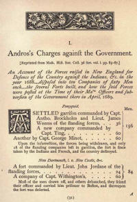 |
Andros Charges Against the Government
From the The Andros Tracts
His report on the condition of the forts in Maine as of April 1689
Andros reported that Saco had 88 men. He had addressed the desertion of those men in a letter written in his own hand and dated April 12, 1689, six days before he was deposed.
|
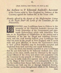 |
Answer to Andros Charges from Inter-charter papers at Mass Historical Society
"Saco fort was deserted in Sir Edmund's time for want of necessaryes and provisions for the soldiers, and Captain Floyd himself made prisoner by Sir Edmund upon his coming to aske provisions for the necessarye subsistance of that garrison".
They knew of no fort at Kennebunk (Cape Porpoise)
|
 |
Cape Porpoise Old & New by Henry F. Knight May 3, 1894 from Collections of the Maine Historical Society Second Series Vol VI pg 153
Description of Fort begins on pg 166
Who was Henry F Knight?
Author of the speech given before an appreciative Cape Porpoise crowd, Harvard Law student, Henry F. Knight was just 20 years old when on May 3, 1894, he stood before the scholarly audience at the Maine Historical Society, and described the artifacts he had collected at the site of the old Stage Island Fort. His father, Clarence H. Knight (son of Francis from NH) was a publisher with Mills, Knight, & Co, 115 Congress St Boston, MA. His mother, Julia Holden was from a prominent Dorchester family of Albert P Holden (John). Henry, or Harry in the familiar, married Mabel________ in 1901 and moved to 131 Cedar St in So Braintree, MA. The couple had three daughters, Eleanor, who became a public school teacher, Margeret and Julia a.k.a. Louise. Henry's WWI registration indicates that he practiced law at 50 State Street in Boston. I have not found marriages of any of the three daughters. My hope is that the artifacts collected at Stage Island are still in someone's attic or have been donated to an Historical Society or Museum.
Clarence H. Knight, also present at Cape Porpoise, published Poland Spring Maine Hiram Ricker & Sons (Mills, Knight & Co. Boston, MA; 1883) Dorchester Woman's Club Cook-Book. Published for the Bazaar, Nov. 4th, 5th, 6th, Norfolk Hall, Dorchester. Boston: Press Mills, Knight & Co., 1897
Bosson, Charles P. History of the Forty-Second Regiment Infantry, Massachusetts Volunteers, 1862, 1863, 1864. Boston: Mills, Knight & Co., 1886.
|
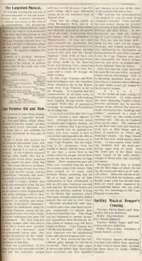 |
These two articles from The Open Sea Sept 27, 1894, describe an entertainment including a reading by Henry Knight of Harvard. This followed the Maine Historical Society reading. Henry is a student at Harvard. Henry says the fort has been taken down. |
|
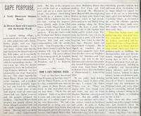
|
This 1905 mid-summer Wave article is a sales pitch for the Cape Porpoise Land Company, a.k.a. The Electric Road Company, a.k.a. Goodall, who bought Stage Island among other Cape Porpoise properties, hoping to develop them. It states that the clubhouse was built on the exact location of the fort. Perhaps Freeman's, gold speculator's cottage, was an earlier version. |
|
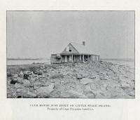
|
This is their new clubhouse in the same issue of The Wave. |
|
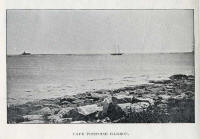
|
Also from the same 1905 issue of The Wave. |
|
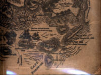 |
Islands on William Barry Map |
|
|
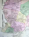
on 1872 Map |
|
|
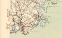
1944 map.
Look at the dot on Stage Island (Fort Island) It shows up again and again on survey maps.
According to the Midsummer 1905 Wave article, the dot indicates the location of the clubhouse and therefore the fort. |
|
|
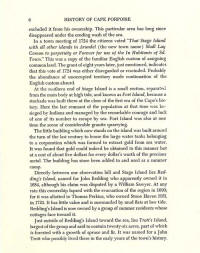
What Freeman says about the Fort and the dot on the survey maps. He also says that Fort Island was once the "scene of considerable granite quarrying. A scary thought but quarrying would have taken place well before Harry Knight found artifacts at the still visible Fort site.
Read a charming description of Cape Porpoise written by May B. Whiting and published in the Dearborn Independent in 1926. Mention is made of gold prospecting on Fort Island here |
 |
Cape Porpoise Gold Rush
During Klondike Gold Rush Reverend Prescott Jernegan saw a solution to his financial woes in the new public obsession with bling. He claimed to have invented a process for extracting gold from seawater by some secret combination of electrical and chemical reaction. Several capitalists were invited to accompany Jernegan to a little shack at the end of a deserted wharf on the Rhode Island coast. There he promised they would witness the first test of his mysterious “Accumulator”. The apparatus consisted of a box containing mercury. Two platinum wires ran under water from the box to a homemade battery at the wooded shore. In the presence of the capitalists the accumulator was lowered into the water through a trap door in the floor of the dark little hut. The next morning the mercury had been replaced with gold. The Electrolytic Marine Salts Company was incorporated with a capital stock of $10,000,000 in shares of $1 each. Several of the capitalists who witnessed Jernegan’s "successful demonstration" were summer residents of Kennebunkport. Rather than purchasing expensive shares of his company they made plans to reproduce his apparatus on Fort Island. The Cape Porpoise Land Company purchased the island on July 2, 1897. During the year that followed activities on the island were shrouded in secrecy.
|
| |
When the Cape Porpoise gold rush didn't pan out. The Cape Porpoise Land Company asked the State Legislature to allow them to build toll bridges for foot and carriage traffic or a tramway between the mainland and Stage Island and the mainland and Trotts Island. Permission was granted March 16, 1899. They ended up scraping the bridge project but not before laying out lots on Trotts Island. The plan is at the registry of deeds in Alfred. |
|
|
What Bradbury says about the Fort |
|
|
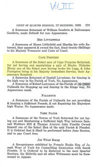
This page is from Volume III if Maine Province & Court Records. It confirms that as of December 1688, Nicholas Morey had indeed broken his leg and was therefore excused from the proceedings. It also confirms that John Purington was in "his Majesty immediate Service". Barry said that John Purington was commander of the Fort at Stage Island as of 1688. |
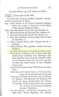 |
Maine Historical Society Documentary Series Vol V pg 91, lists Garrisons, Soldiers &c, in the Province of Maine as of April the 30th 1690. It says that all companies from Cape Porpus and Kennebunk had left by April 30. Do they refer to military men only or had the inhabitants left by then as well? |
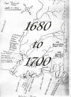 |
Settlers who owned land in Cape Porpoise at the time of the attack at left.
The following group of men assisted in building a mill in 1687; John Loring, John Barrett, William Thomas, Richard Blancher, Thomas Mussey, Wm Barton, Jacob Wormwood, John Miller, Simon Cundy, Emanuuel Davis, John Sanders, Jr(def), John Batson, John Rennals.
Others who may have been here in 1689 were Nicholas Moorey, John Davis, John Purington, Thomas Boardman, Thomas Beers, Thomas Kimball, Samuel Scadlock
"January 24th, 1688-9. Ten chosen five selectmen and a constable, at a legal town meeting, legally warned by Order, for selectmen and other officers. For selectmen, Lieu. John Purington, John Downing, John Miller, John Davis, Richard Randall. For constable Immanuel Haynes. For Town clerk, Lieu. John Purinton. For lott layers, and surveyors, Lieu. Purinton, Richard Randall, John Sanders, John Miller. William Barton, Jacob Wormwood." pages 48-49
Full set of Decade Maps
The Book of Eastern Claims says Samuel Scadlock purchased land from Pendleton Fletcher. The deed was never recorded but it was signed on April 13, 1689, the day after Edmund Andros wrote to John Puddington ordering him to come to Boston to explain why he had released the soldiers under his command at Stage Island Fort. The soldiers at Saco had also deserted by April 12. It is not known if Pendleton Fletcher was one of the soldiers that marched to Boston to participate in the overthrow of Edmund Andros but it is certainly possible. He was Lt of a company of soldiers stationed at Saco Falls in 1693.
|
  |
Who was Nicholas Morey?
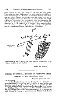
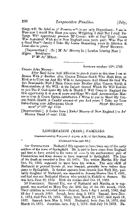
Nicholas Moorey was born 1663 son of Thomas and Mary of East Worldham, co Hants. He emigrated in 1675. He had a Wells grant in Aug 1684. Married Mary Pendleton Cross between Oct 1684 and March 1685. He bought 150 acres at Cape Porpus Feb 1685-6. See http://www.mykennebunks.com/map%20settlers%201680-1700%20web.JPG . He had a tavern license there Oct 1686-1687, was a grand juror 1687 and a selectman 1688. His house, which was being Garrisoned, was burned by Indians in April 1689. At the time of his heroic departure from Cape Porpus he was 26 years old. He moved to Taunton, MA by 1692, Freetown 1716 and Dighton 1722 where he died 4 Mar 1730-1. Letters from Nicholas Morey to his nephew in London were printed in the NEHGS register vol 35:235. See letters at left. Also see Nicholas Morey's family home in England http://www.fieldclub.hants.org.uk/publications/news44/build44a.html
Legislators of the Massachusetts General Court, 1691-1780
Freetown HR 1721M; selectman 1688; M Mary (Pendleton) (Britton) Cross (c1653-1732) in c1685, no ch; innkeeper, carpenter; will. Three black slaves. Moved from Wells to Taunton, Freetown, and Dighton by 1722. No committees.
1956 Pendleton g 42-9; Torrey 518; Bristol Co Prob Abs 1:193, 195, Gen Dic of ME & NH |
|
|
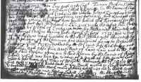
Proprietors book on page 23, June 6 1732. According to Adelaide Day's notes it said that there was a circular enclosure 30 yards diameter with two watchtowers. The Proprietors gave it to the inhabitants for their use in 1724. The Island was laid out to Thomas Perkins in 1732 except 1 acre burying ground and 1 acre where fort was built. | |
What's New?
King William's
War in Maine - The rest of the story
Chronological Table of
sources
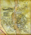 Atlas Maps of the Kennebunks Atlas Maps of the Kennebunks
 Kathy Cmaylo 2010 find

Kathy Cmaylo's 2009 find
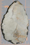
Kathy Cmaylo's 2008 find
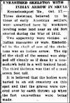
Arrowhead unearthed in Kennebunkport embedded in settler's skull
Maine History Reseach
Known Indian Attacks Attacks took place on Trotts Island, Vaughn Island, and at the Cape Porpoise garrison house.
17th Century Mill at Grist Mill Property
someoldnews.com
Old News Column published in the York County Coast Star
So ME Old News

Promote Your Page Too |
